
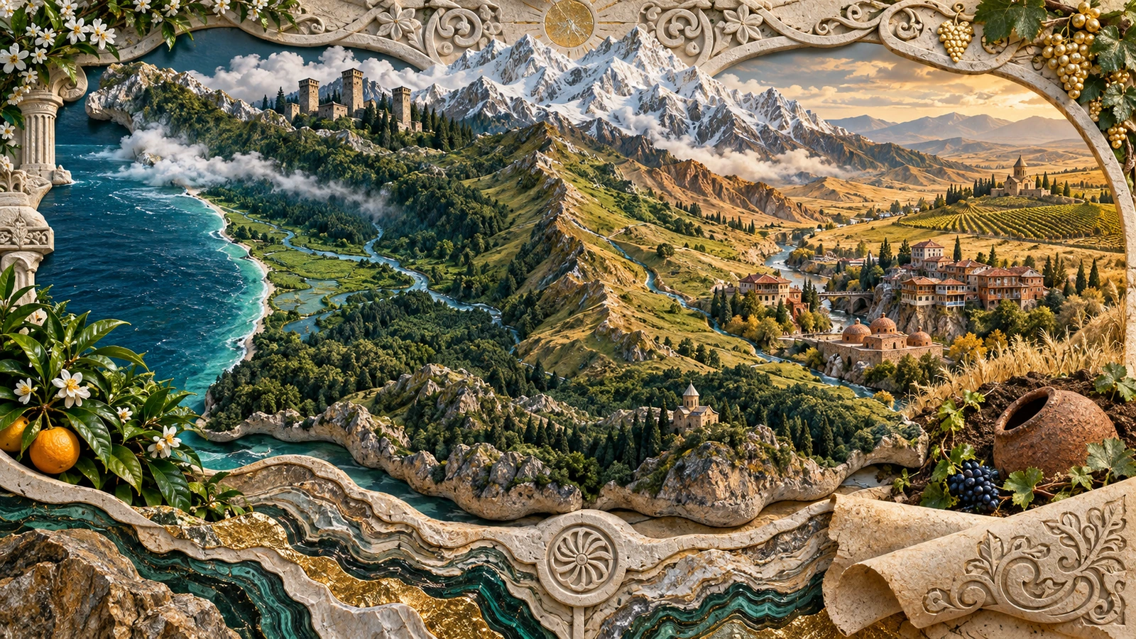
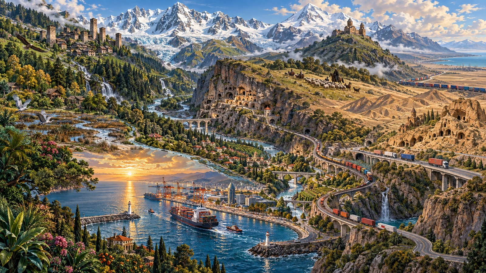
The land area is 69,700 square kilometers, the highest point is about 5,200 meters, and the Black Sea coastline is about 310 kilometers. There are subtropical coasts with an annual rainfall of about 2,400 mm, and grape growing valleys with an annual rainfall of about 500 mm. The main language belongs to an independent family of four principal languages. Three historical writing systems survive, each in a different sphere of use.
This issue covers the country itself: its physical geography, climate, history, languages and religions, the formation of its capital, food traditions, major natural regions and relations with China. It does not revisit assisted-reproduction law or the fertility industry, which were covered in Issue 22.
Location and terrain: a country between two mountain systems
The land area is 69,700 square kilometers, the highest point is 5,201 meters, and the Black Sea coastline is 310 kilometers
Georgia is in the western part of the South Caucasus. It borders Russia to the north across the Greater Caucasus Mountains, Türkiye and Armenia to the south, Azerbaijan to the southeast, and the Black Sea to the west. With a land area of 69,700 square kilometers, it is about the same size as China's Ningxia Hui Autonomous Region. [1]
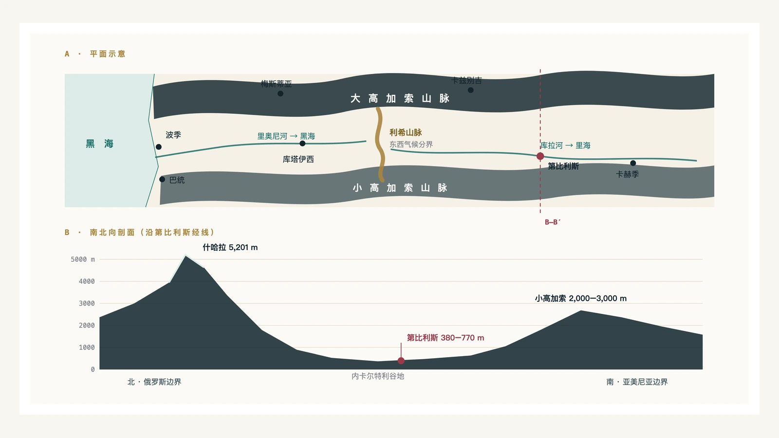
The terrain can be divided into three broad zones. The northern edge is the Greater Caucasus Mountains, which form the boundary between Georgia and Russia; the southern edge is the Lesser Caucasus Mountains, which is slightly lower in altitude and transitions to the Turkish and Armenian plateaus; between the two mountains is an east-west lowland and river valley belt, on which almost all the cities, cultivated land and transportation lines in the country are distributed.
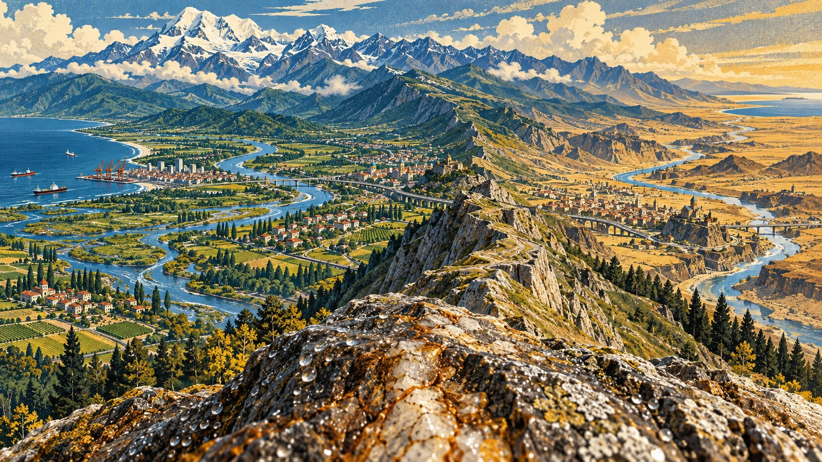
The uplift of this section of the Greater Caucasus occurred when the Arabian Plate squeezed the Eurasian Plate northward, and it is still continuing today. This is also the reason for the frequent earthquakes in the South Caucasus. The highest point in the territory, Mount Shkhara, is about 5,200 meters above sea level and is located in the Svaneti region in the northwest. The mountain itself straddles the Georgia–Russia border. Mount Kazbek is about 5,050 meters above sea level; its base can be reached in one day from Tbilisi. [2]
There is a mountain ridge in the middle that is not well-known but determines the face of this country: the Likh Range. It runs north-south, connecting the Greater Caucasus and the Lesser Caucasus, and also divides the country into east and west halves in the middle. The significance of this mountain ridge is in the next chapter.
The water system is also divided by it. In the western half, the Rioni River flows westward into the Black Sea, and its mouth is the Port of Poti; in the eastern half, the Kura River (Mtkvari River in Georgian) flows from northeastern Turkey, crosses Tbilisi, enters Azerbaijan eastward, and finally flows into the Caspian Sea. Although the country is small, its rivers drain into two separate seas.
Along the Black Sea in the west is the Colchis Lowland. The terrain is low and flat, with some areas close to sea level. Historically, a large area was a swamp. After drainage improvements in the 20th century, it became an agricultural area. The east is a series of valley basins separated by hills, with altitudes mostly between 300 and 800 meters. Kakheti, Shida Kartli and Kvemo Kartli all belong to this category.
Climate: East and west halves separated by a ridge
The annual precipitation in Batumi is 2,435 mm, and that in Tbilisi is about 500 mm. The straight-line distance between the two places is 300 kilometers
There is often moist airflow from west to east over the Black Sea. After the airflow enters western Georgia, it is first lifted by the Meskheti Mountains on the northern slope of the Lesser Caucasus, and then encounters the Likh Range. Most of the moisture falls on the western side. Batumi in the west receives about 2,400 millimeters of annual precipitation, making it one of the wettest cities in the Caucasus; across the Likh Range, Tbilisi receives about 500 millimeters of annual precipitation. The straight-line distance between the two places is less than 300 kilometers. [3]
A site's precipitation, vegetation, and crops are determined by two conditions: which side of the Likh Range it is on, and its altitude. Places at the same altitude on the west side are much wetter than those on the east side, and this difference holds true across the country.
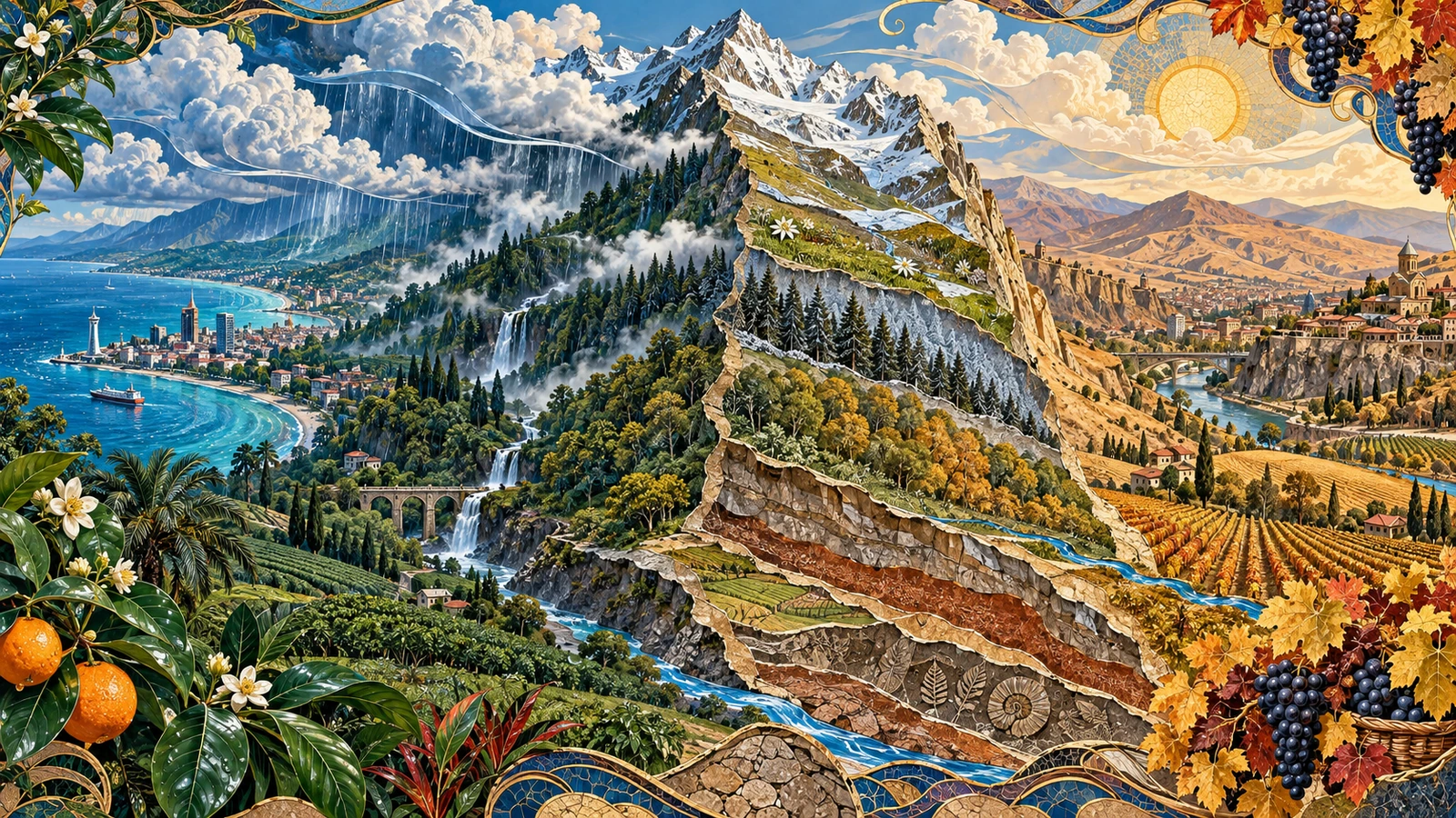
This divide also separates two broad agricultural zones. Adjara, Guria, and Samegrelo in the west belong to the humid subtropical zone, with mild winters and long frost-free periods. During the Soviet period, tea, citrus, and laurel were planted on a large scale here. Today, there are still tea gardens in the Batumi area. Kakheti and Kartli in the east have a semi-arid continental climate, with hot summers, long sunshine hours and little rain in autumn, which are suitable for grape ripening and harvesting. The vast majority of Georgia’s wine is produced in the east, and here’s why.
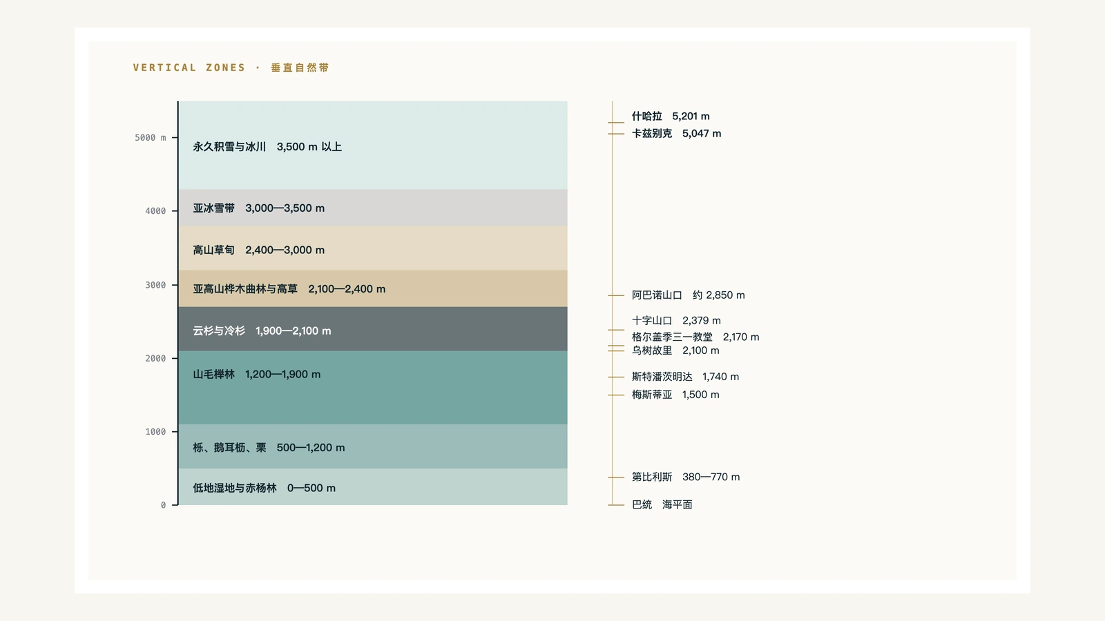
Elevation adds a second dimension, creating a continuous sequence of vertical zones. The lowlands generally go up through broadleaf forest, mountain coniferous broadleaf forest, coniferous forest, subalpine zone, alpine meadow and sub-ice and snow zone, and finally enter the permanent snow and glacier area; the specific boundaries will change with the slope direction and the humidity in the east and west. Svaneti's villages are spread out between 1,400 and 2,200 meters, and the snow is deep in winter, with some roads closed to traffic for several months each year.
Visitors can experience two kinds of weather on the same day. In Tbilisi in July, the daytime temperature is often above 32 degrees and the air is dry; the temperature in Batumi on the same day is around 28 degrees, the humidity is close to saturation, and there are frequent showers in the afternoon. In January, Tbilisi is around freezing, Batumi is around 7 degrees, and the seaside rarely freezes.

History: From Colchis to Today
Two ancient kingdoms, one Christianization, three centuries of schism, two independences
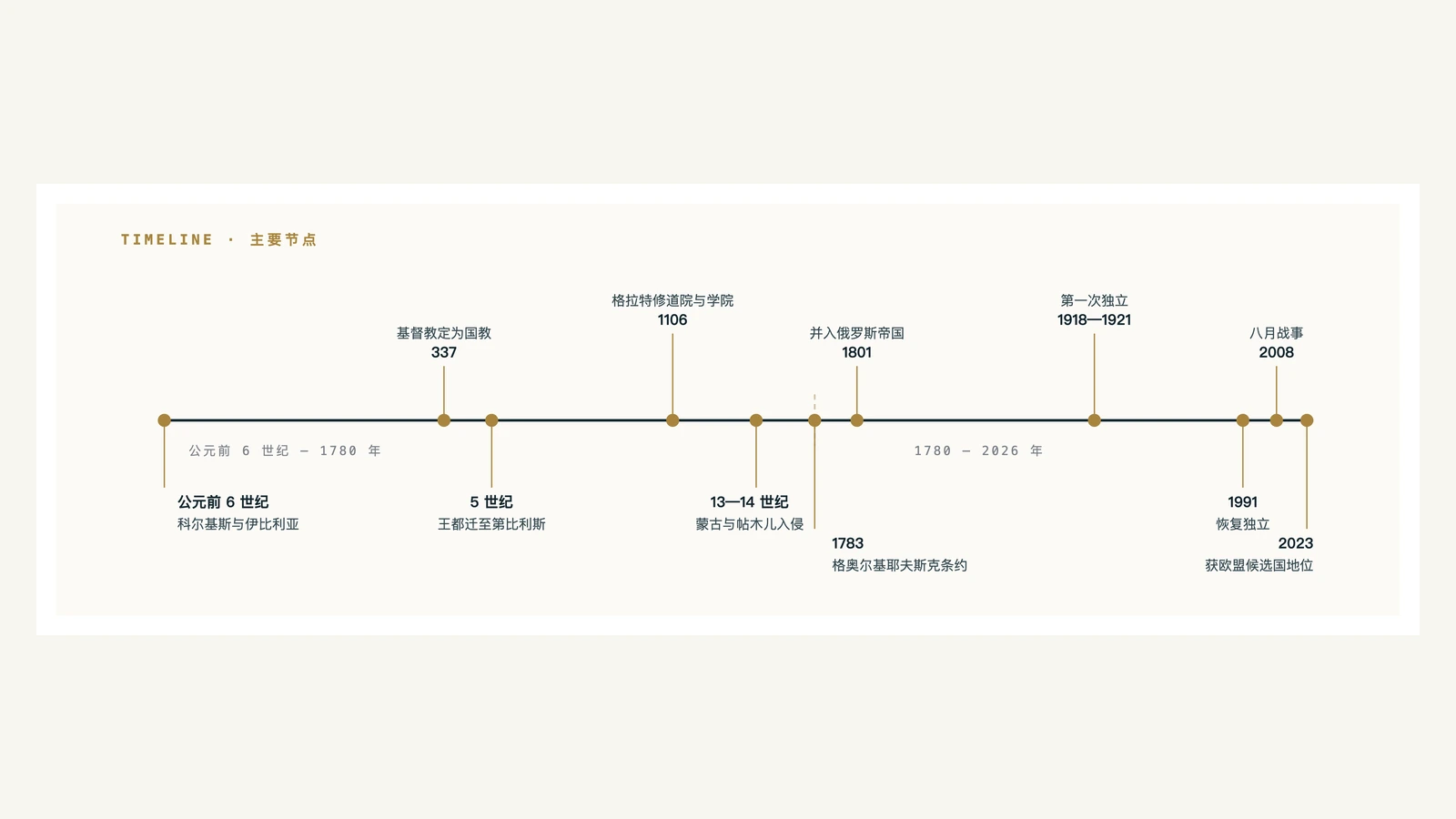
Two major political entities existed here in antiquity. To the west is Colchis, with which the Greeks have had maritime contacts for a long time. The destination of Jason's voyage to obtain the Golden Fleece in ancient Greek mythology was located here; one interpretation links the legend to a local practice of using sheepskins to collect alluvial gold from rivers. To the east was the Iberian Kingdom, centered at Mtskheta on the Kura River.
In 337, King Mirian III of Iberia proclaimed Christianity the state religion at Mtskheta, one of the world's earliest state-level conversions, predating the official establishment of Christianity in the Roman Empire. Mtskheta still retains the Svetitskhoveli Cathedral and the Jvari Monastery, and the entire complex was included in the World Heritage List in 1994. [4]
King Vakhtang Gorgasali began to build Tbilisi in the 5th century; his son Dachi completed the construction in the 6th century and moved the royal capital from Mtskheta to Tbilisi. The Arabs entered the South Caucasus in the 7th century and established the emirate in Tbilisi. Their rule lasted until the 11th century. [4]
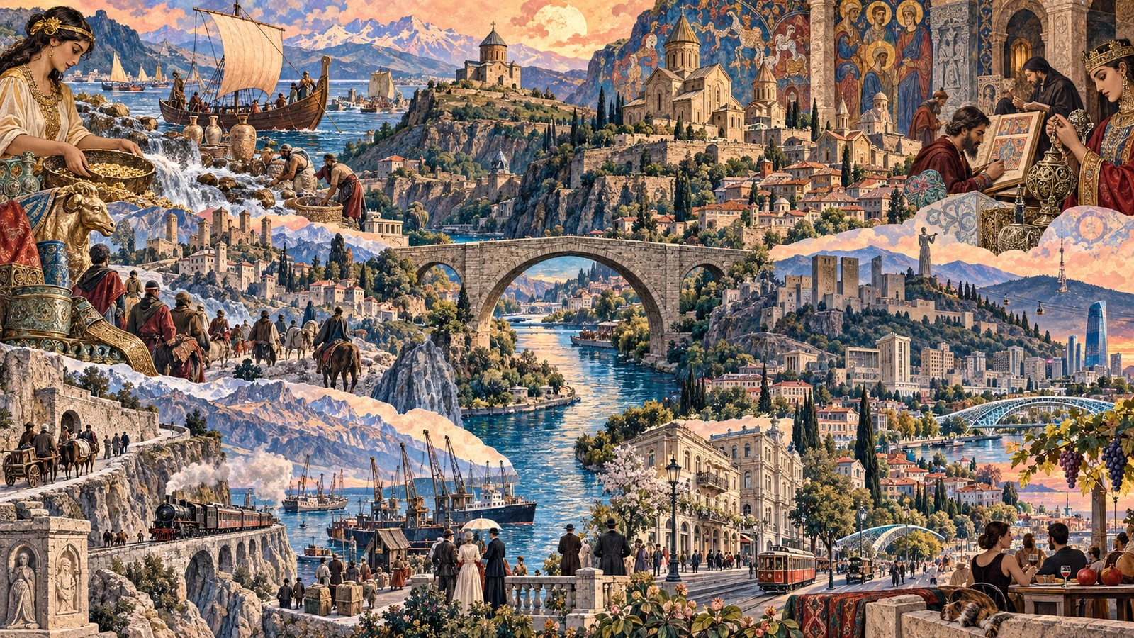
Georgia reached a high point from the late 11th to the early 13th century. David IV (reigned 1089-1125) reconquered Tbilisi and unified all areas; during the reign of his great-granddaughter Queen Tamar (reigned 1184-1213), the kingdom expanded southward to present-day Armenia and eastern Turkey. Gelati Monastery, which began construction in 1106, was both a religious centre and an academy where philosophy, astronomy and geometry were taught. It was listed on the World Heritage List in 1994. The architecture, murals, metalwork and epic poem The Knight in the Panther's Skin of this period formed a cultural benchmark that was repeatedly cited by later generations.
Mongolian armies entered the South Caucasus in the 13th century, Timur attacked Georgia eight times at the end of the 14th century, and the unified kingdom disintegrated into a number of principalities. For the next three centuries, the eastern part was under the influence of Safavid Persia for a long time, while the western part was under the influence of the Ottoman Empire, and the borders moved repeatedly due to wars.
In 1783, the eastern Kingdom of Kartli-Kakheti signed the Treaty of Georgievsk with Russia and accepted Russian protection. Russia abolished the kingdom and annexed it to the empire in 1801, with the western principalities being annexed over the following decades. During Russian rule, the Georgian Military Road, the ports of Batumi and Poti, and the Transcaucasus Railway were built, and Tbilisi became the administrative center of the empire in the Caucasus.
The Democratic Republic of Georgia was established in May 1918 and lasted less than three years. The Red Army entered Tbilisi in February 1921 and was later incorporated into the Transcaucasian Soviet Federation, becoming one of the Soviet republics in 1936. On April 9, 1991, Georgia declared its restoration of independence.
In the more than three decades since independence, several points in time are often mentioned: the civil war and regional conflicts in the early 1990s; the regime change in November 2003; and the several-day war with Russia in August 2008. Abkhazia and South Ossetia are currently not under the actual jurisdiction of the central government. Georgia gained EU candidate status in December 2023; the EU Council said its accession process has effectively stalled since 2024. The Georgian government announced in November 2024 that it would not include the launch of EU accession negotiations on its agenda before the end of 2028. [5][6]
Language, writing and beliefs
An independent language family, three writing systems that still exist, and an autonomous church
The locally spoken Georgian language belongs to the Kartvelian language family, also called the South Caucasian language family. This language family usually includes four main languages: Georgian, Mingrelian, Svan and Laz, and is mainly distributed in the southern foothills of the Caucasus. It has not been confirmed to be related to Indo-European, Turkic or other language families, so it is usually regarded as an independent language family. There are approximately four million users.
The verbs in this language can mark the person of both the subject and the object, and one word often corresponds to a short sentence in Chinese. There are also many consonant concatenations, and it is not uncommon for five or six consonants to appear in one syllable. For outsiders, the difficulty is not mainly in vocabulary, but in verb morphology.
Georgia retains three systems of historical writing, each of which is used differently today. Asomtavruli first appeared in stone inscriptions in the 5th century; Nuskhuri has been used in religious manuscripts since the 9th century; Mkhedruli has been used since the 11th century, with a total of 33 letters. It is a common script in education and daily life today. Asomtavruli and Nuskhuri are mainly preserved in the Georgian Orthodox Church, traditional crafts and cultural education. The three systems continue to this day. In 2016, they were included in the UNESCO Representative List of the Intangible Cultural Heritage of Humanity under the name "Living Culture of the Three Writing Systems of the Georgian Alphabet". [7]
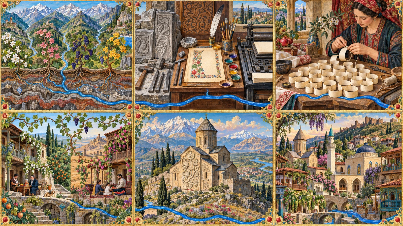
Mkhedruli has no distinction between upper and lower case, its rounded letterforms are built largely from curved strokes. It is highly recognizable on signboards, books and street signs. Street nameplates are often printed in both Georgian and Latin transliterations.
Geography encoded in surnames
The suffix of the surname carries regional information: -shvili (meaning "child") is more common in the east; -dze (meaning "son") is more common in the west; -iani comes from Svaneti; -ava and -ia come from the Mingrel region. Upon hearing a surname, locals can roughly determine which area the family comes from.
Church and religious architecture
The Georgian Orthodox Church is an ancient autocephalous Eastern Orthodox church. In the 2014 census, about 80% of the population identified with the Orthodox Church; about 10% were Muslims, mainly Georgians in the Adjara region in the southwest and Azerbaijani residents in the southeast; and believers of the Armenian Apostolic Church accounted for about 3%.
Georgian churches have a recognizable form: a cross-in-square plan, a central drum and a conical dome. The outer walls are built with neatly cut stones, and there are often bas-relief crosses and grapevines on the front. Most mountain churches are built on high places with wide views. The Gergeti Trinity Church in Kazbegi, located at an altitude of 2,170 meters, is a well-known example of this type of setting.
The cross arms of the Georgian cross drop slightly. Traditionally, this shape comes from St. Nino, a missionary in the 4th century. She tied grape vines into a cross and tied it with her own hair, so that the vines curved naturally. Grapevines and faith have long been linked in this country.
Tbilisi: hot springs, river valleys and hills
The permanent population is about 1.28 million, and the urban altitude is 380 to 770 meters
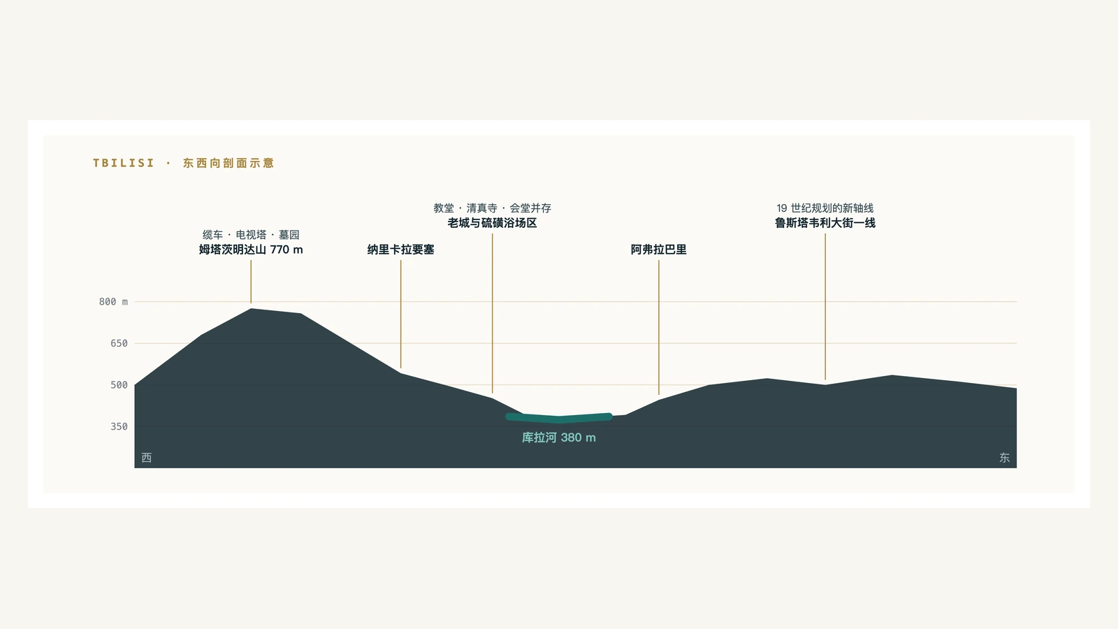
The city's name comes from the Georgian word tbili, meaning warm, and refers to the city's sulfur hot springs. According to tradition, the 5th-century King Vakhtang Gorgasali was hunting here. His falcon chased a pheasant and fell into the spring. The king discovered this spring and decided to build a city here. The old city still retains a bathing area called Abanotubani. A low brick dome is exposed above the ground. Below is a sulfur bath drawn from an underground spring. The water temperature is between 38 and 40 degrees all year round.
Tbilisi is located in a canyon cut by the Kura River. The river enters the urban area from the northwest and flows out to the southeast. Both sides of the river are gradually rising terraces and ridges. The city's altitude rises from 380 meters above the river to about 770 meters at the top of Mtatsminda Mountain. The city spreads along the river valley, so it is narrow from north to south and long from east to west, and the main roads basically follow the river.
The old city is on the west bank of the river, under the ridge where the Narikala Fortress is located. The earliest parts of the fortress date back to the 4th century, and additions have been made in subsequent generations, with mainly the late medieval walls remaining today. Looking down from the fortress, you can see the roofs of the old city, the carved wooden balconies and the church domes stacked on top of each other, and below that is the dome of the bathing area.
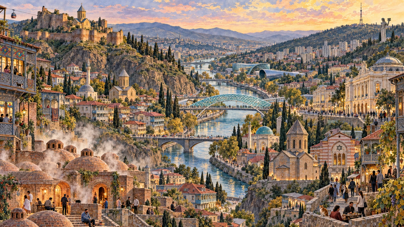
Another characteristic of the Old Town is the density of religious buildings. Within a few hundred meters there are the Georgian Orthodox Church, the Armenian Apostolic Church, a mosque and a synagogue. This is related to the city's long history as a trade route node: Persians, Armenians, German immigrants, Jewish traders and Russian officials settled here at different times.
In 1795, Persian troops invaded and burned Tbilisi, nearly razing the city. Most of the houses seen in the old town today were rebuilt in the 19th century, and the style of wooden balconies with stained glass was formed during that period. During the Russian rule in the 19th century, a new axis of the city was planned, today's Rustaveli Street, along which the Opera House, the National Museum, the Parliament Building and the Theater were located, with architectural styles ranging from neoclassical to Moorish.
During the Soviet period, the city expanded significantly to the east and west, forming vast multi-story residential areas. The subway opened to traffic in 1966. In the past two decades, a number of contemporary buildings have been added. The glass-and-steel Peace Bridge, concert hall and exhibition hall are all built between the old city and the river bank, forming a clear contrast with the surrounding old houses.
Tbilisi's summers are hot and dry, with daytime temperatures often above 32 degrees in July and August, and the sunshine is strong. Winters are mild, with average temperatures around zero degrees, and there is not much snowfall and a short retention time. The city spreads along a relatively closed river valley, and it often feels hot in midsummer afternoons.
Population, cities and livelihoods
There are 3.7045 million residents in the country, about one third of whom live in the capital
As of January 1, 2025, the country's permanent population was 3,704,500, of which the urban population accounted for 61.5%; Tbilisi had 1,282,600 people, accounting for approximately 34.6% of the country. The above population figures exclude Abkhazia and South Ossetia. [1] Compared with the late Soviet Union, today’s total population is significantly lower. Migration is one of the main reasons, and changes in statistical coverage and methodology also have an impact.
Other cities are much smaller. Batumi is the capital of the Autonomous Republic of Adjara in the southwest, a Black Sea port, and a seaside city in summer. A number of high-rise buildings have been built along the coastline in the past two decades. Kutaisi is inland in the west and has long been the royal capital of Western Georgia. The Gelati Monastery is located in the valley outside the city. Rustavi, south of Tbilisi, is a metallurgical industrial city planned during the Soviet period. Telavi in the east is the center of the Kakheti wine region, and its population temporarily increases during the autumn harvest.
In terms of ethnic composition, Georgians account for the vast majority of the population. The two main ethnic minorities have clear settlement areas: Azerbaijanis concentrated in Kvemo Kartli in the southeast, and Armenians concentrated in Samtskhe-Javakheti in the south. In the villages of these two areas, it is common to use the native language in daily communication.
There are generational differences in the actual use of language. Most people over the age of 50 can speak Russian, which is the result of education during the Soviet period; the English proficiency of people under the age of 30 has improved rapidly, especially in the service industries of Tbilisi and Batumi. Svan and Mingrelian can still be heard in mountainous villages. They belong to the same language family as Georgian but are not mutually intelligible.
The currency is the lari, introduced in 1995, with the symbol ₾. Each of the several pillars of the economy is small in scale, but has a clear structure: agriculture exports wine, hazelnuts, citrus and tea; mining exports copper concentrates and ferroalloys; electricity is mainly hydropower, accounting for the majority of power generation. The country's rivers have steep elevation drops and relatively stable runoff. Hydropower stations are distributed on water systems such as the Rioni River and the Nguri River. The proportion of tourism and transit transportation has continued to rise in recent years, and remittances from overseas workers are also an important source of foreign exchange.
Wine: Clay pots buried in the ground
Earliest known evidence of winemaking, 525 native varieties, a container still in use today
Gadachrili Gora and Shulaveris Gora, about 50 kilometers south of Tbilisi, are two Neolithic settlement sites. A study published in 2017 conducted a chemical analysis of pottery pot fragments unearthed here and detected tartaric acid and other wine-characteristic components on the inner wall. The age was about 6000 BC, about 8,000 years ago. This is the earliest known evidence of winemaking, predating previous similar evidence found in Iran by about a thousand years. [8]
These pottery pots are similar in shape to the qvevri still used in local rural areas today: egg-shaped, without handles, with a narrow mouth and broad body, and a volume ranging from hundreds to thousands of liters. When in use, apply a layer of beeswax on the inner wall to seal the pores, and then bury the vessel underground, leaving only its mouth at ground level.
The main function of being buried underground is to reduce temperature fluctuations. The temperature difference throughout the year is small one to two meters underground, so traditional fermentation and aging can be carried out in a relatively stable environment. After the grapes are broken, they are placed in the qvevri with the skins, seeds, and sometimes stems. They are sealed and fermented, and then left to rest in the same qvevri for several months. White grapes will be macerated with their skins for a long time, resulting in an amber-colored, astringent wine; the revival of what is called amber wine or orange wine in the contemporary international market is closely related to traditional Georgian crafts. This method was inscribed on UNESCO’s Representative List of the Intangible Cultural Heritage of Humanity in 2013. [9]
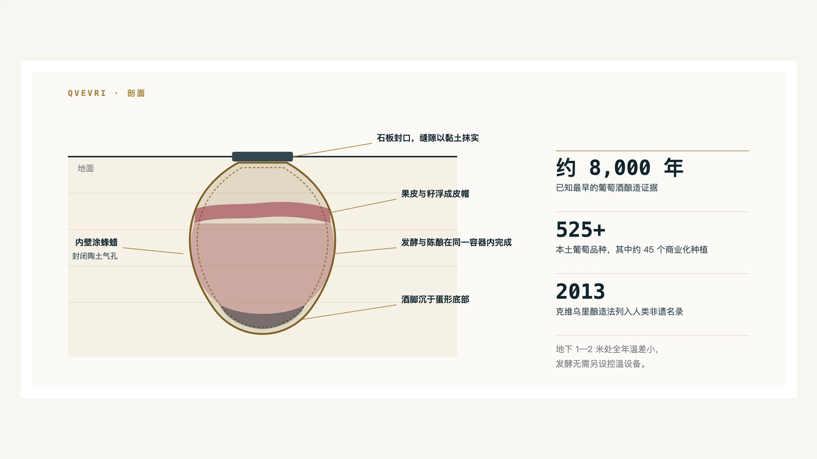
In terms of varieties, more than 525 native grape varieties have been recorded in Georgia, about 45 of which are commercially grown. The red grapes are mainly Saperavi, the skin and pulp are pigmented, and the wine is dark in color; Rkatsiteli has the largest planted area among white grapes. In addition, there are local varieties such as Mtsvane and Kisi. [10]
The production areas are concentrated in the east. Kakheti is the core production area, responsible for most of the country's production; Kartli, Imereti, and Racha each have their own varieties and styles. Imereti in the west also uses clay pots, but the soaking time is usually shorter than in Kakheti, and the wine color is lighter.
Home brewing is still common in rural areas. The family’s jars are buried in the yard. In autumn, the grapes are harvested, broken, and put into jars. The jars are opened the next year, part of which is consumed by oneself and part given to others. This wine does not appear in commercial statistics, but household production remains substantial.
There are two points in time worth remembering at the industry level. Georgia was a major supplier of wine during Soviet times, and production was volume-oriented. Russia imposed an import ban on Georgian wine in 2006, which lasted until 2013. This period forced Georgian wineries to turn to European, North American and East Asian markets, and also led to the emergence of a number of small wineries that used qvevri craftsmanship as a selling point.
Food and the table: walnuts, spices and a toastmaster-led feast
The differences in cuisine between the east and west roughly coincide with the climate dividing line
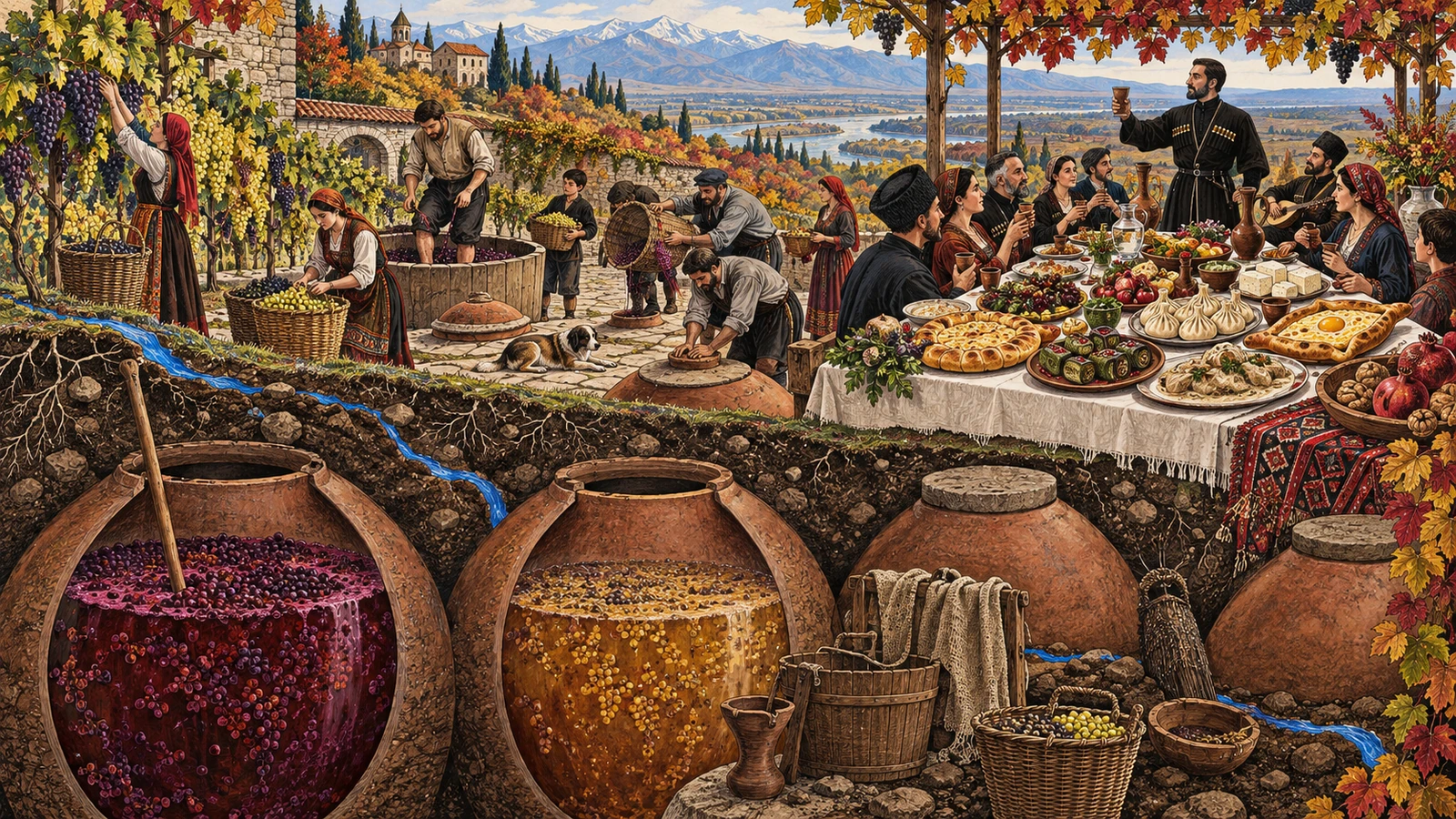
Three ingredients recur throughout Georgian cooking: walnuts, spices and cheese. Walnuts are ground into a paste that forms the base of many cold dishes and stews; there are many varieties of cheese, ranging from Suluguni in the west to hard cheeses in the mountains; and the most recognizable spices are blue fenugreek and dried marigold powder, which is yellow in color and is also known locally as local saffron.
Khachapuri is the most common daily food, a kind of baked flatbread filled with cheese. The shapes vary from place to place: the Imereti style is round and sealed; the Adjarian style is made into an open boat shape. Before taking it out of the oven, crack an egg in the center and put a piece of butter. When eating, tear off the edge of the dough and dip it in. The former comes from the western interior, the latter from the Black Sea coast.
Khinkali are large pleated dumplings filled with broth that originated in the mountains of the Northeast. The way to eat is to pinch the dough knot at the top, take a small mouthful to drink the soup, and then eat the whole thing. The dough knot is usually left on the plate.
Walnut-based dishes include satsivi (a cold dish with walnut sauce, traditionally served with turkey and a New Year's dish), pkhali (small balls of blanched vegetables mixed with walnut puree), and eggplant rolls with walnut sauce. Bread is baked in a clay oven called a tone. The dough is attached to the wall of the oven and comes out of the oven in the shape of a long and narrow boat. The Borjomi Gorge in the south-central region produces the carbonated mineral water of the same name, which has been bottled for export since the 19th century.
supra and tamada
A formal feast is called a supra and is led by a tamada, or toastmaster. The tamada is appointed by the host and is responsible for proposing the toasts in order, and those present drink after each round. The sequence of toasts has a relatively fixed framework: peace, deceased relatives, family members present, children, and guests, all unfolding in order, with someone in the middle able to make additional remarks. A supra can last for hours, as dishes arrive continuously and plates accumulate across the table.
There are several related rules: wine is poured by the host or the neighbor, and guests generally do not pour the wine themselves; wine is used when toasting, not beer; others do not start another topic when tamada is speaking. These practices have been simplified for everyday dinner parties in the city and remain intact in rural and formal settings.
Mountains: Svaneti, Kazbegi and Colchic Rainforests
From sea level to about 5,200 meters, there are multiple natural zones distributed along the altitude gradient
In an area of less than 70,000 square kilometers, the straight-line distance from the Black Sea coast to the snow line is no more than 100 kilometers. Changes in the vertical direction are therefore more pronounced than in the horizontal direction: vegetation, crops, house forms and road traffic periods all change with altitude.
Svaneti
Svaneti is located in the western section of the southern slope of the Greater Caucasus. It is surrounded by mountains on all sides. Historically, it has been difficult to enter and exit. Therefore, it has retained its independent dialect, customs and architecture. Mestia, the administrative and transportation center, is located at an altitude of 1,500 meters; Ushguli, about 45 kilometers further east, is located at an altitude of 2,100 meters, making it one of the highest permanently inhabited villages in Europe. [11]
The landmark building in this area is the stone tower, locally called Koshki, which has four to five floors. The walls are narrow at the top and wide at the bottom, with an overhang at the top. Most of the existing ones were built in the 12th to 13th centuries. The towers and connected residences form a family residence and defense system. The towers mainly serve as observation and defense functions. Upper Svaneti along with these towers was included in the World Heritage List in 1996. Mount Shkhara is just north of Ushguli. On a clear day, you can see the main peak and the glaciers below it from the entrance of the village. [11]
The snow here is deep in winter. The road to Mestia has been improved in recent years, but the section leading to Ushguli is still difficult to pass for several months.
Kazbegi and the Georgian Military Road
Heading north from Tbilisi, drive about 165 kilometers along the Georgian Military Road to the Georgian-Russian border. This passage through the Greater Caucasus has a long history. Russia transformed it into a modern military road from the late 18th to the 19th century; on the way, it passed a Cross Pass with an altitude of 2,379 meters. Along the route, you pass Ananuri Fortress, Zhinvali Reservoir and the canyon, and the landscape gradually changes from river valley broadleaf forest to alpine meadow. [12]
At the northern end of the road is the town of Stepantsminda, formerly known as Kazbegi, at an altitude of about 1,740 meters. On the hillside behind the town stands the Gergeti Trinity Church, 2,170 meters above sea level. It was built in the 14th century and is within walking distance of the town. Behind the church is Mount Kazbek, 5,047 meters above sea level, a dormant stratovolcano with multiple glaciers. [12]
Tusheti
Tusheti is in the northeast corner, bordering Russia's Dagestan and Chechnya. Access to this area involves crossing the Abano Pass, which is approximately 2,850 meters above sea level and is one of the highest drivable mountain passes in the country. It is only open during the summer months of the year. The region still follows seasonal transhumance: cattle and sheep go up to the alpine pastures in summer, and go down to the eastern plains before winter. The village consists of stone houses and towers and has a small permanent population during the winter.
Colchic Rainforests and Wetlands
An area in the west along the Black Sea was inscribed on the World Heritage List in 2021 as Georgia's first natural heritage site. [4] These temperate rainforests preserve ecosystems with roots in the Neogene: evergreen shrub layers are developed, there are many vines, and many of the tree species are relict species from the Quaternary Ice Age. The relatively mild climate of the southwestern Caucasus during the Ice Age made this area a refuge where tree species that had disappeared elsewhere in Europe survived.
Adjacent to the rainforest are peat bogs. This type of swamp is fed by precipitation and is highly acidic. It is a rare type in Europe and western Eurasia. The east coast of the Black Sea is also a passage for migratory birds. In autumn, large numbers of raptors migrate south along the coast. The Batumi area is an observation point.
The semi-arid south
Opposite the mountains to the north are the arid landscapes to the south and southeast. Vardzia is located on the tuff cliff in the upper reaches of the Mtkvari River. It was excavated in the 12th century. It originally had more than ten floors and hundreds of caves, including churches, living rooms, water channels and storage spaces. A strong earthquake in 1283 caused the outer rock mass to collapse, exposing the internal structure.
In the southeast, near the border with Azerbaijan, David Garejaa is a group of rock-cut monasteries that were excavated starting in the 6th century and are scattered among the semi-desert hills. The annual precipitation in this area is low, and the vegetation is sparse. It turns green briefly in spring, and is mainly yellow-brown in the rest of the time. Together with the snow mountains and meadows of the north, this creates one of the country's sharpest landscape contrasts.
China–Georgia relations
Diplomatic relations were established in 1992, the free trade agreement came into effect in 2018, and mutual visa-free travel took effect in 2024
China and Georgia established diplomatic relations on June 9, 1992. In May 2017, the two sides signed a free trade agreement, which came into effect on January 1, 2018. More than 90% of products are subject to zero tariffs. This is the first free trade agreement signed between China and a country in Eurasia. It is also the first free trade agreement launched and concluded by China after the Belt and Road Initiative was proposed. [13]
The two countries established a strategic partnership in July 2023; on the 34th anniversary of the establishment of diplomatic relations in June 2026, the bilateral relationship was upgraded to a comprehensive strategic partnership. Preliminary data from the National Bureau of Statistics of Georgia show that the volume of goods trade between China and Georgia in 2025 was approximately US$2.313 billion. China accounts for 9.0% of Georgia’s total trade in goods, ranking fourth in terms of trade volume and the third largest source of imports. [14][16]
In terms of personnel exchanges, the two countries signed a mutual visa exemption agreement on April 10, 2024, which took effect on May 28, 2024. Chinese citizens holding ordinary passports can enter Georgia without a visa, with a single stay not exceeding 30 days and a cumulative stay not exceeding 90 days in every 180 days. [15]
On the route, there are direct flights between Tbilisi and Urumqi, operated by Air China and China Southern Airlines, usually taking about 5 to 6 hours one way. Flight frequency adjusts with the season; departures from other Chinese cities often require connecting flights in Urumqi, Central Asia or the Middle East. [17]
The dynamic data collection and verification time for this issue is September 13, 2026. Population follows the National Statistics Office of Georgia's 1 January 2025 release, excluding Abkhazia and South Ossetia; the land area and administrative division data include the above regions. Trade uses preliminary data for 2025. Climatic data are multi-year averages, and there will be large differences in a single year. Flight schedules are adjusted seasonally, and travellers should check the operating carrier's timetable before departure.
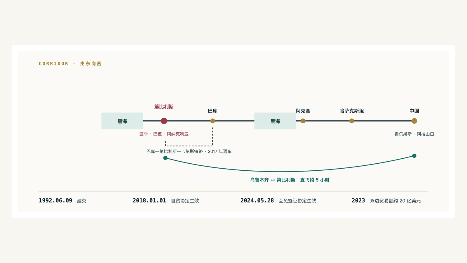
Georgia is geographically located on the Trans-Caspian International Transport Corridor: goods travel from China via Kazakhstan to the east coast of the Caspian Sea, cross the sea to Azerbaijan, and then pass through Georgia to the Black Sea port or transfer to the Turkish railway network. The Baku-Tbilisi-Kars railway, which opened in 2017, is a key section of this line, and the ports of Poti and Batumi on the Black Sea coast are its outlets. The Anaklia deep-water port project on the north side continues to advance, where offshore dredging began in August 2026. [18] This corridor's traffic volume is also affected by the ports along the route, railway transport capacity and regional situations.
Check country context against the current pathway
This profile focuses on Georgia's land and culture. Travel, visa, medical and legal plans require a fresh check with the competent authority, carrier and relevant professionals.
Public sources and data scope
Population, trade, bilateral relations, visas and port progress were checked to 13 September 2026. Natural and cultural heritage information primarily follows UNESCO and official agencies.
- Geostat: Population as of 1 January 2025
- Geostat: Population database
- UNESCO: Historical Monuments of Mtskheta
- Council of the EU: Georgia policy page
- UNESCO: Three writing systems of the Georgian alphabet
- PNAS: Early Neolithic wine of Georgia
- UNESCO: Traditional qvevri wine-making method
- National Wine Agency of Georgia: Indigenous grape varieties
- UNESCO: Upper Svaneti
- UNESCO: Colchic Rainforests and Wetlands
- MOFCOM: China–Georgia Free Trade Area
- Ministry of Foreign Affairs of China: Comprehensive strategic partnership (2026)
- Ministry of Foreign Affairs of Georgia: Mutual visa exemption
- Geostat: External merchandise trade of Georgia 2025
- Tbilisi International Airport: China Southern Airlines route
- Ministry of Economy of Georgia: Anaklia dredging works
This country profile is not travel, immigration, medical, legal or investment advice. Check current rules and schedules with the competent authority and carrier.